RKK's Wind and Wave
JR
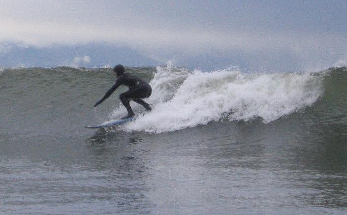
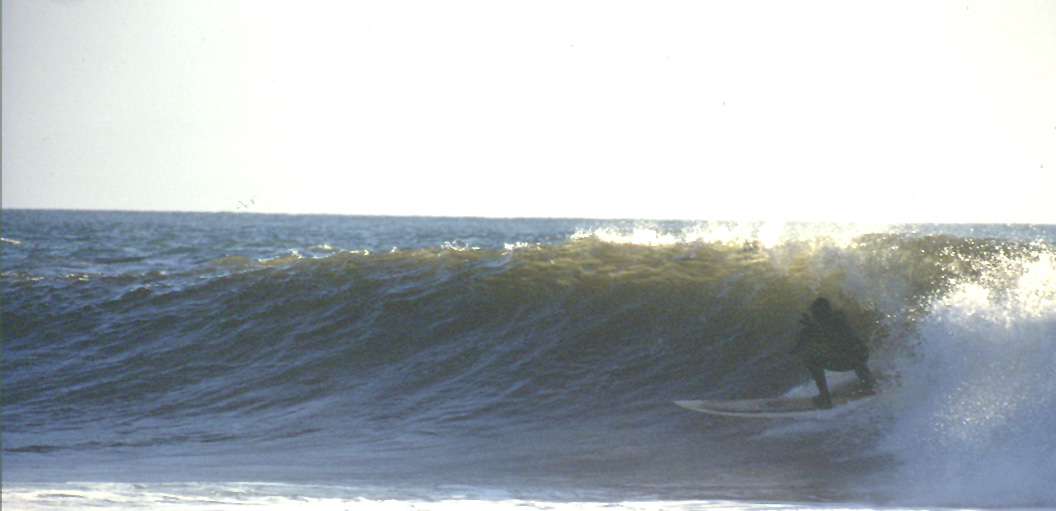
SURFING AT JORDAN RIVER
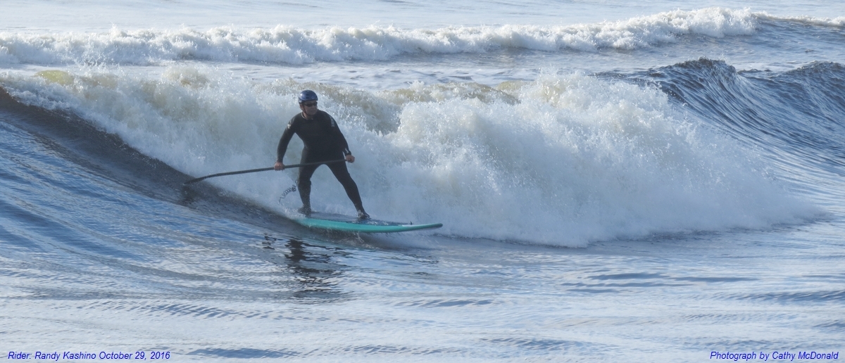
Surfing Ku Hoĕ Style At Jordan River
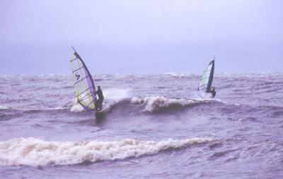
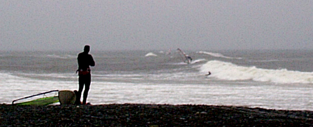
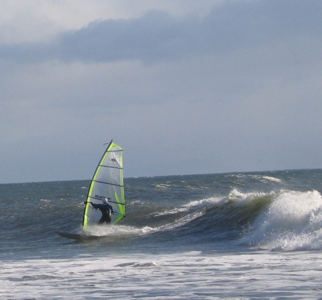
WAVESAILING AT JORDAN RIVER
October 12th, 2003
October 30th, 2004
Click Here to See Images of Wave Sailing Session April 29, 2007
Marine Forecast from Environment Canada
CURRENTS AT JUAN DE FUCA STRAIT ENTRANCE

Tide Heights at Point No Point

Big Wave Dave's Gordons Beach Web Cam
Current Significant Wave Height Analysis from NOAA/NCEPNote: Click on Image to see Animation of Forecast
Current Significant Wave Peak Wave Period Analysis from NOAA/NCEP
Note: Click on Image to see Animation of Forecast

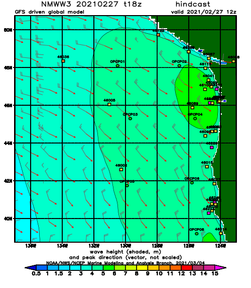
From the U.S. Navy Fleet Numerical Oceanograhic Center
Link to Latest North Pacific WAVE Model Analysis
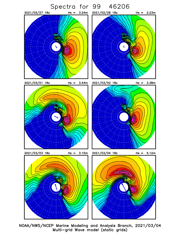
Directional Wave Spectra MODEL for La Perouse Bank off Ucluelet and Tofino
Note:
Depending on the time of day these models are not always displayed.
The radial lines in the plots depict the directional resolution of the model.
I.E. Direction TOWARD which waves are predicted to go.
The concentric circles are plotted at 0.05 Hz intervals, where the innermost circle corresponds to 0.25 Hz.
ie. 0.05, 0.10, 0.15, 0.20, 0.25 Hz which for us SURFERS respectively corresponds to
20 second, 10 second, 7 second, 5 second and 4 second Waves.
The arrow in the middle depicts wind speed and direction.
Colours represent wave energy density for spectra rates of energy density plotted at a logarithmic scale.
More info on these can be found at the NOAA WAVEWATCH III website http://polar.wwb.noaa.gov/waves/products.html
For Comparison Directional Wave Spectra Model for La Perouse Bank Weather Buoy (46206)
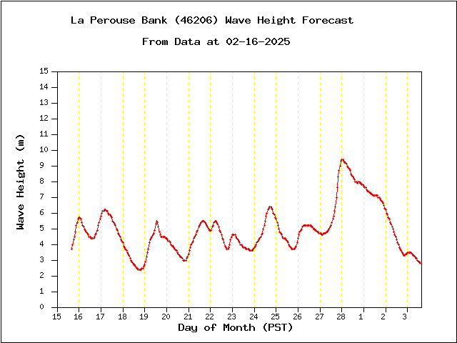
Following wave height forecast charts derived from the above directional spectra.
Wave Height is Significant Wave Height meaning the average of the highest 33 percent of the observed waves.
Latest Long Range Wave Forecast for La Perouse Bank(46206), Model Data is 3 Hourly
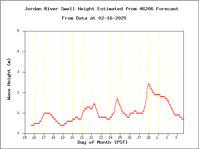
Latest Long Range Swell Height Forecast for Jordan River, Model Data is 3 Hourly
based on La Perouse Bank(46206) NOAA Forecast Models.
Note: For this model Swell is defined as waves with periods greater than 9 seconds.
There could be wind waves with periods less than 9 seconds, but a nice clean swell is really Da kine.
Link to Experimental Sombrio Swell Forecast
Link to Experimental Port Renfrew Swell Forecast
Link to Experimental Whiffen Spit Swell Forecast
Important Disclaimer :
The user assumes the entire risk related to its use of this data. This data is provided "as is," and the author disclaims any and warranties, whether expressed or implied, including (withoutlimitation) any implied warranties of merchantability or fitnessfor a particular purpose. In no event will the author be liableto you or to any third party for any direct, indirect, incidental, consequential, special or exemplary damages or lost profit resulting from any use or misuse of this data.
This page has been accessed
212835
times
since 2006/04/16